What is Precision Agriculture Data Interpretation?
Precision Agriculture Data Interpretation Training
The Precision Agriculture Data Interpretation certificate program equips agronomists, farm managers, and data analysts with the skills to transform raw field data into actionable decisions. This course covers the entire data lifecycle—from sensor-based collection and GPS mapping to geostatistical modeling and machine learning—so you can optimize inputs, boost yields, and reduce environmental impact. By the end, you will be able to build prescription maps, interpret soil and remote sensing imagery, and implement data-driven management strategies that directly improve farm profitability and sustainability.
The program is structured for a beginner-friendly yet rigorous progression, starting with foundational concepts like data quality and spatial fundamentals, then advancing through exploratory analysis, geostatistics, and yield/soil interpretation, and culminating in variable rate application and decision support systems. Each of the twelve lessons balances theoretical frameworks with hands-on practice, building four core skill areas: spatial data handling, statistical reasoning, agronomic interpretation, and machine learning application. Choosing this program now positions you at the forefront of agriculture's digital transformation, where data literacy is becoming as essential as agronomic expertise—and where early adopters gain a significant competitive edge in precision farming.
What is Precision Agriculture Data Interpretation?
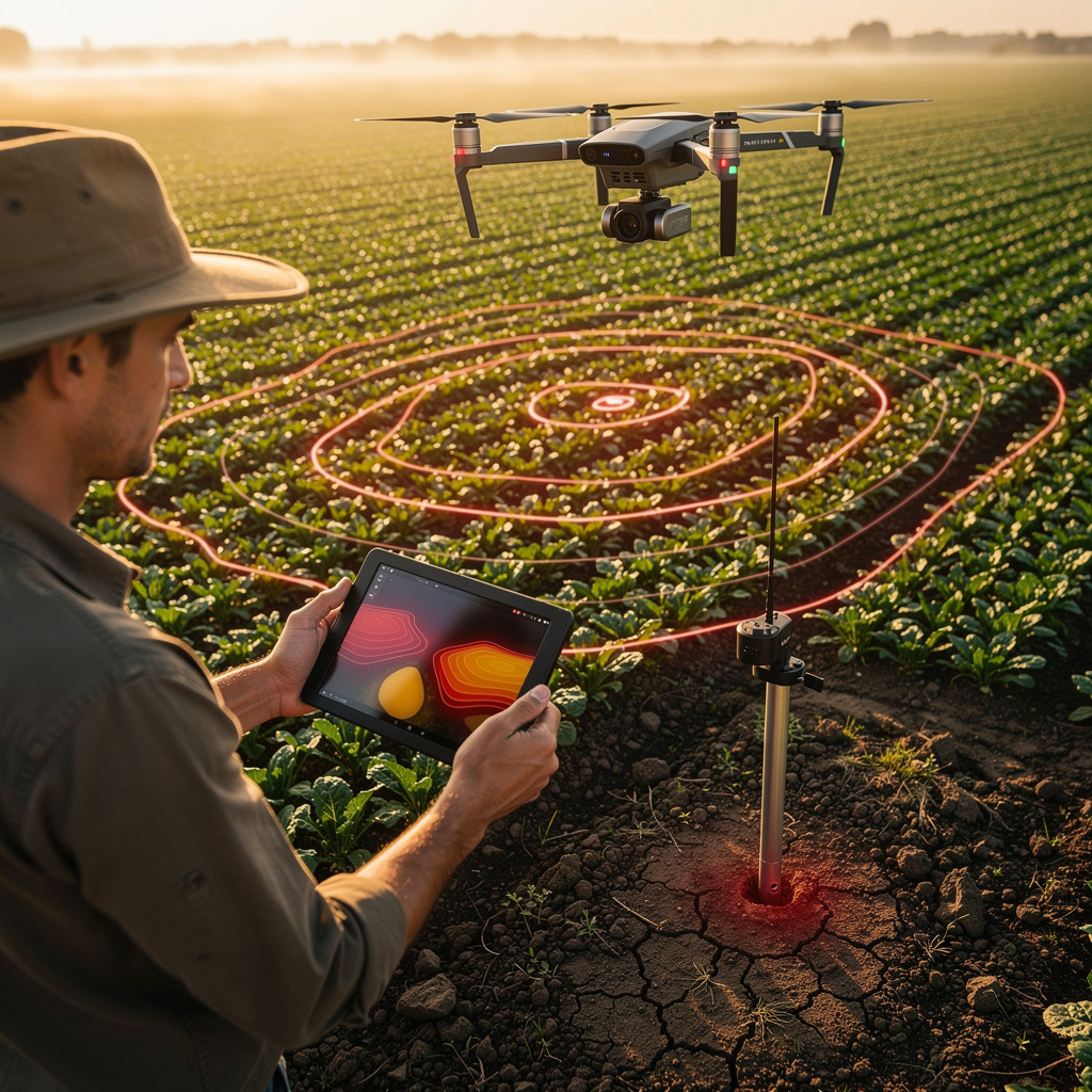
Precision Agriculture Data Interpretation is the scientific discipline of extracting meaningful patterns and insights from the vast datasets generated by modern farming technologies—GPS-guided equipment, yield monitors, soil sensors, drones, and satellite imagery. Its core concepts include spatial variability analysis, geostatistical interpolation (like kriging), data preprocessing to remove noise, and the creation of management zones that reflect field heterogeneity. The field integrates agronomy, statistics, and computer science to answer questions such as: where are yields consistently low, what soil properties drive that variation, and how should inputs be adjusted accordingly?
Today, this subject matters more than ever as global pressures mount to increase food production while reducing chemical runoff and greenhouse gas emissions. Real-world applications span from large-scale commodity farms optimizing nitrogen application to specialty crop growers using remote sensing to detect water stress early. Recent shifts include the proliferation of low-cost IoT sensors, the integration of satellite data with farm management software, and the rise of machine learning models that predict pest outbreaks or nutrient deficiencies. These advances have moved precision agriculture from a niche experiment to a mainstream necessity, with agribusinesses and research institutions actively seeking professionals who can turn terabytes of data into clear, defensible recommendations.
Mastering this subject builds a robust skill stack that combines quantitative rigor with agronomic intuition—covering spatial statistics, data cleaning, visualization, and predictive modeling. For agronomists, it enhances their ability to diagnose field issues; for data scientists, it provides a rich domain for applying algorithms; for farm operators, it offers a pathway to cost savings and yield gains. Beyond the farm gate, these skills are valuable in agricultural consulting, equipment manufacturing, crop insurance, and environmental monitoring, where understanding the "why" behind data patterns is critical. The subject empowers learners to move from reactive observation to proactive, site-specific management—a capability that is increasingly indispensable in a data-rich agricultural landscape.
Common Questions About Precision Agriculture Data Interpretation
How does the Precision Agriculture Data Interpretation certificate boost my CV?
Is this course suitable for someone with no agronomy background?
How does IDW interpolation handle uneven point distribution?
- Weight calculation: Each known point's contribution is proportional to 1/d^p, where d is distance and p is the power parameter (typically 2).
- Uneven distribution: When points cluster, IDW naturally reduces the influence of redundant nearby samples because their weights compete, while isolated points retain strong local control.
- Practical outcome: The method produces smooth surfaces in dense areas and more generalized estimates in sparse regions, which is why the interpolation workflow in geostatistics treats IDW as the fast deterministic recipe before moving to more complex kriging approaches.
What is the difference between vector and raster data models?
Why does NDVI saturate in dense vegetation?
How do you clean raw yield monitor data effectively?
- Remove known system failures: Filter out records flagged by the monitor during harvest, such as header-up or swath-width transitions.
- Trim edge and turn rows: Delete passes shorter than a minimum length and the first and last seconds of each pass, where the header is not fully engaged.
- Apply agronomic thresholds: Reject yield values outside a plausible range for the crop and field, and flag moisture readings that fall outside the sensor's calibrated window.
- Check spatial consistency: Compare adjacent passes and remove isolated spikes that deviate sharply from their neighbors, since a single erroneous point can distort interpolation.
Does high NDVI always guarantee high crop yield?
What Will This Course Bring You?
- Analyze foundational concepts of precision agriculture data to identify key variables and their roles.
- Evaluate data collection technologies such as sensors and drones for suitability in specific agricultural contexts.
- Apply preprocessing techniques to clean and standardize raw agricultural data for subsequent analysis.
- Build spatial data models using GIS principles to represent spatial field variability.
- Perform exploratory data analysis to uncover patterns and anomalies in agronomic datasets.
- Apply geostatistical methods to interpolate unsampled locations and create continuous spatial maps.
- Interpret yield data to identify spatial and temporal variability and infer causal factors.
- Design variable rate application prescription maps based on soil and yield data.
Curriculum
12 Units1. Foundations of Precision Agriculture Data
1 hour
2. Data Collection Technologies
1 hour
3. Data Quality and Preprocessing
1 hour
4. Spatial Data Fundamentals
1 hour
5. Exploratory Data Analysis
1 hour
6. Geostatistics and Interpolation
1 hour
7. Yield Data Analysis
1 hour
8. Soil Data Interpretation
1 hour
9. Remote Sensing Data Interpretation
1 hour
10. Variable Rate Application and Prescription Maps
1 hour
11. Statistical and Machine Learning Approaches
1 hour
12. Decision Support and Data-Driven Management
1 hour
Exam – Precision Agriculture Data Interpretation
20 Questions • 70% Pass • 30 min
Unlock All Units for Free
Create an account, enroll in the course, and start with the first unit right away.
Exam – Precision Agriculture Data Interpretation
20 Questions • Pass: 70% • 30 min
Course Duration
720
Total Minutes
12
Unit
1
Final Exam
~60
Min / Unit
Precision Agriculture Data Interpretation Certificate Program
Document Your Skill
Those who pass the 20-question, 30-minute exam with 70% receive the Precision Agriculture Data Interpretation Certificate.
Stand Out on Your CV
By adding your certificate to your CV, gain a professional reference in job applications and stand out from the crowd.
Career Advantage
Catch Wisdom certificates are recognized by HR departments and increase career opportunities.
CERTIFICATE FEE
At the end of the course, an online exam consisting of 20 questions with a 30-minute time limit is given. The exam appears automatically after you complete the topics. Anyone who scores at least 70 out of 100 on the certificate exam is awarded the Precision Agriculture Data Interpretation Document (certificate of attendance). You can add the certificate you earn to your CV for job applications in the many sectors listed above, and use it as a reference proving that you took this interactive course.
The Certificate of Achievement you receive with the Precision Agriculture Data Interpretation course program holds value that proves your personal and professional development in the business world. By adding it to your CV, it can serve as an important reference in your job applications. Moreover, compared with certificates from other private training institutions, Catch Wisdom certificates are offered to our participants at a much more affordable price.
Because HR departments recognize Catch Wisdom as a reputable institution in this field, they value these certificates and may evaluate your job applications favorably. For this reason, a Precision Agriculture Data Interpretation course certificate from Catch Wisdom can make your applications more attractive and place you in an advantageous position in the business world.
For more information, we recommend visiting the Support page.
Certificate in 7 Languages
Earning success certificates from our courses is now more meaningful and global. With certificates available in Turkish, English, German, French, Spanish, Arabic, and Russian, we fully unlock the potential of students worldwide.
Why Certificate in 7 Languages?
-
01
Global Skill Development
Receiving your certificates in 7 different languages strengthens your communication skills as you engage with more people worldwide. It lets you operate more confidently and capably on the international stage.
-
02
International Job Opportunities
Employers may see your certificates in multiple languages as a sign of your ability to seize global opportunities. You can open more doors to new jobs and projects.
-
03
Cultural Richness
The chance to earn certificates in different languages helps you build closer ties with various cultures and broadens your worldview. It enriches your global perspective and deepens cultural understanding.
-
04
Ability to Participate in International Projects
Multilingual certificates give you an edge to work more effectively on international projects. They boost your chances of leadership and participation in diverse projects in the business world.
-
05
Prove Yourself on the Global Stage
Certificates in multiple languages let you showcase your skills and knowledge worldwide. You can become an internationally recognized professional.
Language diversity opens worldwide opportunities. If you want to prove yourself in the international arena, join our online Precision Agriculture Data Interpretation course program and begin this journey with us.
Frequently Asked Questions (FAQ)
Is this course paid?
How do I join the course?
Can I take the course at my own pace?
How can I get my certificate?
What are the advantages of the Certified Certificate?
Boost Your Career
Take a new career step with the Precision Agriculture Data Interpretation course. Add your certificate to your CV, stand out in job applications, and open the door to new opportunities in the industry.
StartStudent Reviews
No reviews yet
Enroll in this course and be the first to leave a review about your experience with Precision Agriculture Data Interpretation.
Start